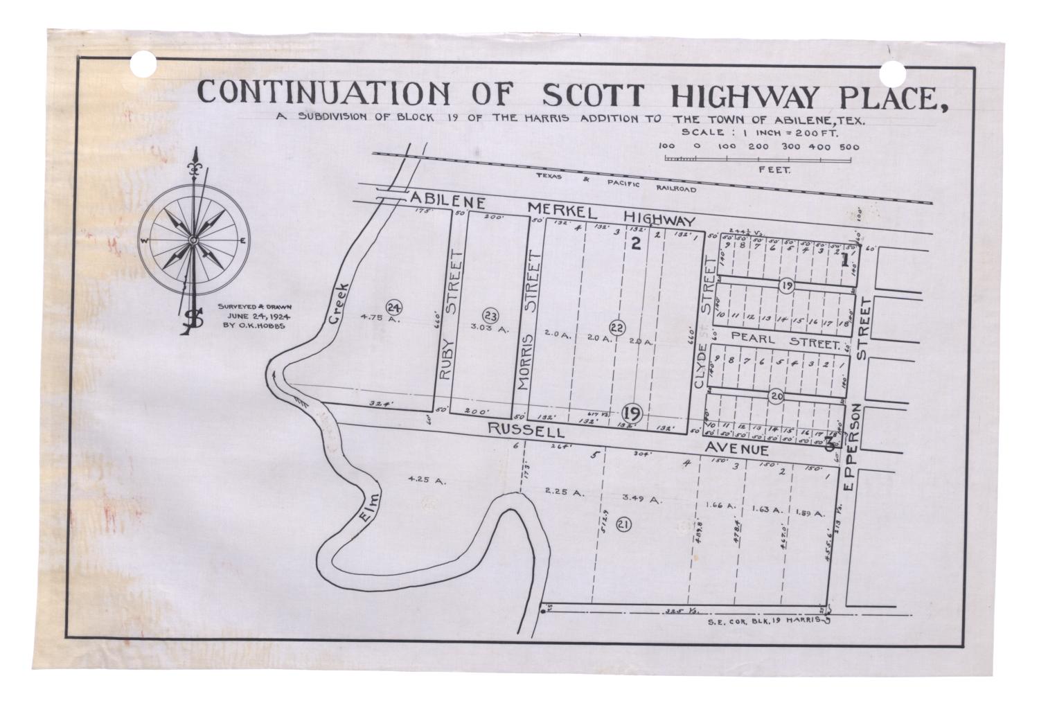
Continuation of Scott Highway Place, a Subdivision of Block 19 of the Harris Addition to the Town of Abilene, Texas [#2] Side: 1 of 2
View a full description of this map.
Related Items
Other items on this site that are directly related to the current map.
[O. K. Hobbs Plat Book] (Book)
![[O. K. Hobbs Plat Book]](data:image/gif;base64,R0lGODlhAQABAAAAACH5BAEKAAEALAAAAAABAAEAAAICTAEAOw==)
This plat book includes an indexed segment in the middle as well as additional plats, assembly drawings, and newspaper clippings that were added to the beginning and end of the compilation. A table of contents on page 115 lists the segments in the middle section of the plat book including an alphabetical index by name (p. 117), an index by number of blocks and surveys (p. 133), eleven index maps, and the plats that were filed through May 1, 1930.
Continuation of Scott Highway Place, a Subdivision of Block 19 of the Harris Addition to the Town of Abilene, Texas [#1] (Map)
Map of the Continuation of Scott Highway Place Subdivision in the city of Abilene, Texas bordered by Abilene Merkel Highway, Russell Avenue, Epperson Street and Elm Creek, and divided by Ruby, Morris, Clyde, and Pearl streets. The block is divided into numbered segments showing property divisions. Scale 1:2,400.
Continuation of Scott Highway Place, a Subdivision of Block 19 of the Harris Addition to the Town of Abilene, Texas [#3] (Map)
Map of the Continuation of Scott Highway Place Subdivision in the city of Abilene, Texas bordered by Abilene Merkel Highway, Russell Avenue, Epperson Street and Elm Creek, and divided by Ruby, Morris, Clyde, and Pearl streets. The block is divided into numbered segments showing property divisions. Scale 1:2,400.
Continuation of Scott Highway Place, a Subdivision of Block 19 of the Harris Addition to the Town of Abilene, Texas [#4] (Map)
Map of the Continuation of Scott Highway Place Subdivision in the city of Abilene, Texas bordered by Abilene Merkel Highway, Russell Avenue, Epperson Street and Elm Creek, and divided by Ruby, Morris, Clyde, and Pearl streets. The block is divided into numbered segments showing property divisions. Scale 1:2,400.
Continuation of Scott Highway Place, a Subdivision of Block 19 of the Harris Addition to the Town of Abilene, Texas [#5] (Map)
Map of the Continuation of Scott Highway Place Subdivision in the city of Abilene, Texas bordered by Abilene Merkel Highway, Russell Avenue, Epperson Street and Elm Creek, and divided by Ruby, Morris, Clyde, and Pearl streets. The block is divided into numbered segments showing property divisions. Scale 1:2,400.
Reference the current side of this Map.
Continuation of Scott Highway Place, a Subdivision of Block 19 of the Harris Addition to the Town of Abilene, Texas [#2], map, June 24, 1924; (https://texashistory.unt.edu/ark:/67531/metapth77841/m1/1/: accessed May 1, 2024), University of North Texas Libraries, The Portal to Texas History, https://texashistory.unt.edu; crediting Abilene Christian University Library.