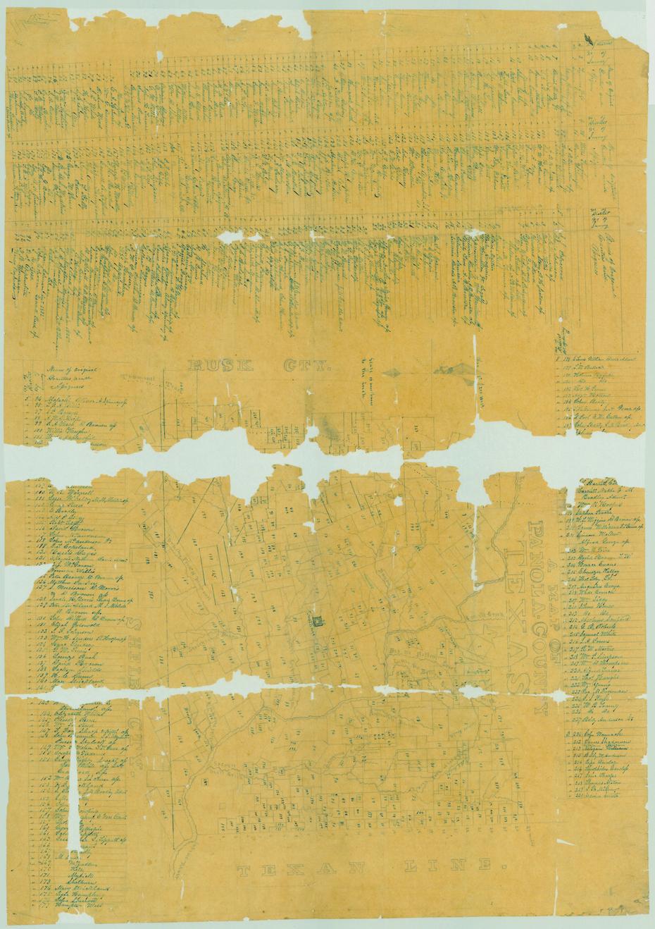
A Map of Panola County, Texas 1850 Side: 1 of 1

View a full description of this map.

brightness
contrast
saturation
exposure
gamma
Applying filters
A Map of Panola County, Texas 1850
                                                
                                                    [Sequence #]: 1 of 1

Tools / Downloads

Get a copy of this side .

Citing and Sharing

Basic information for referencing this web page. We also provide extended guidance on usage rights, references, copying or embedding.

Reference the current side of this Map.

A Map of Panola County, Texas 1850, map, March 14, 1850; (https://texashistory.unt.edu/ark:/67531/metapth89199/m1/1/: accessed April 19, 2024), University of North Texas Libraries, The Portal to Texas History, https://texashistory.unt.edu; crediting Texas General Land Office.

Univesal Viewer

International Image Interoperability Framework (This Page)

Back to Top of Screen