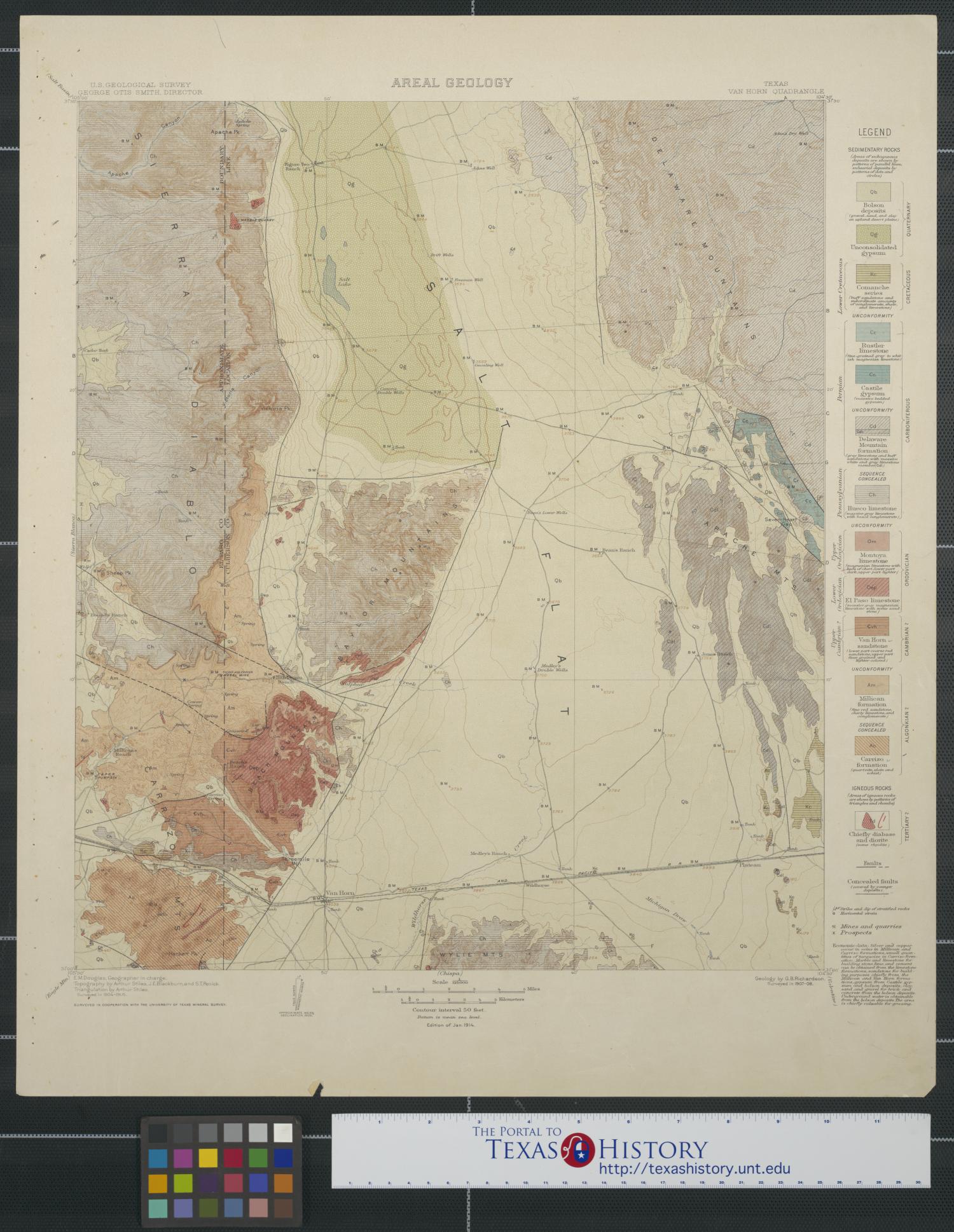
Areal Geology: Van Horn Quadrangle Side: 1 of 2
View a full description of this map.
Related Items
Other items on this site that are directly related to the current map.
Geologic Atlas of the United States: Van Horn Folio, Texas (Book)

This atlas contains three colored maps and aereal views from the regions around the Van Horn, Texas quadrangle including topography, and structure sections of the territory comprising El Paso County and Culberson County. The illustrated text of the atlas discusses the geological elevation of the area, provides in-depth breakdown of the kinds of rocks and minerals as well as the economic geology of the region, precious metals and minerals.
Reference the current side of this Map.
Areal Geology: Van Horn Quadrangle, map, January 1914; Washington D.C.. (https://texashistory.unt.edu/ark:/67531/metadc11823/m1/1/: accessed April 18, 2024), University of North Texas Libraries, The Portal to Texas History, https://texashistory.unt.edu; .